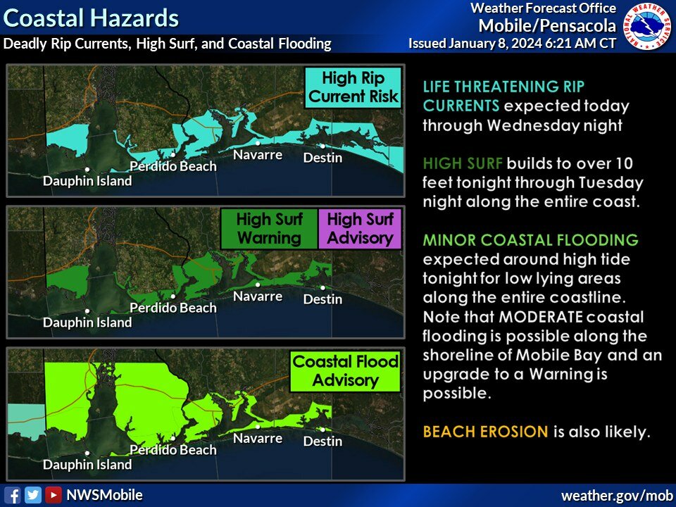
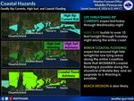
A Coastal Flood Warning is in effect from 6 p.m. Monday to 6 a.m. Tuesday for central Baldwin and Mobile counties ahead of a severe weather system heading toward the area.
According to the National Weather Service, tidal heights of up to around 3 feet are expected to bring coastal flooding. Numerous roads may be closed, low-lying property including homes, businesses and some critical infrastructure may be inundated, and some shoreline erosion will occur.
The NWS warning advises to take actions to protect flood-prone property. If travel is required, do not drive around barricades or through water of unknown depth.
2:45 p.m.
---
The Alabama Department of Transportation urges drivers to take the following steps:
Additional tips for severe weather travel include:
2:55: p.m.
---
An updated message from the National Weather Service of Mobile:
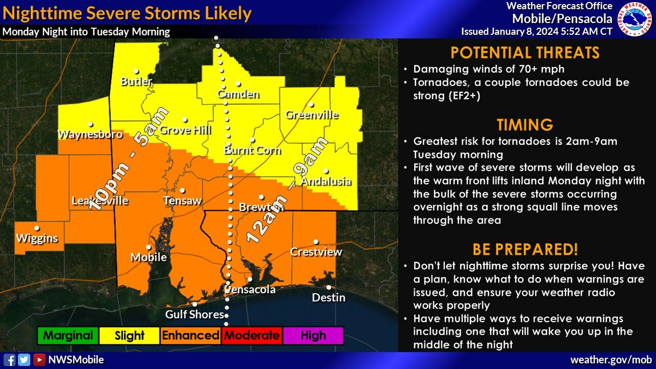
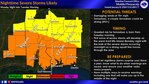
“We have a few updates regarding the potential for high winds and coastal flooding and a minor adjustment to the threat for severe storms/tornadoes.
TORNADOES - The greatest tornado risk for locations west of I-65 is from midnight to 4 a.m. and 2-8 a.m. for locations east of I-65. The greatest risk for strong tornadoes (EF2+) is generally east of I-65.
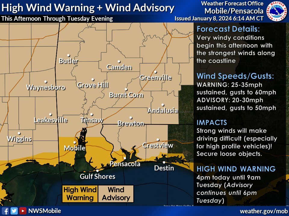
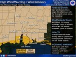
WIND - The High Wind Warning was expanded to include all of Escambia, Santa Rosa and Okaloosa counties in Florida for the potential for wind gusts to 60 mph. A High Wind Warning remains in effect for central and southern portions of Mobile and Baldwin counties in Alabama.
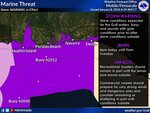
COASTAL FLOOD - A Coastal Flood Warning is in effect from 6 p.m. Monday until 6 a.m. Tuesday for coastal portions of Mobile and Baldwin counties (3 feet of inundation above normally dry ground expected along the coast). A Coastal Flood Advisory remains in effect for coastal portions of Escambia, Santa Rosa, and Okaloosa Counties.
5 p.m.
This story will be updated as more warnings and safety announcements come in.
Read more from Gulf Coast Media: